


I have a degree in mapping and I love how simple the Phoenix Mapping program is. I have used high powered mapping programs and it has all of the functionality of those without losing the simplicity necessary for our industry.
Production
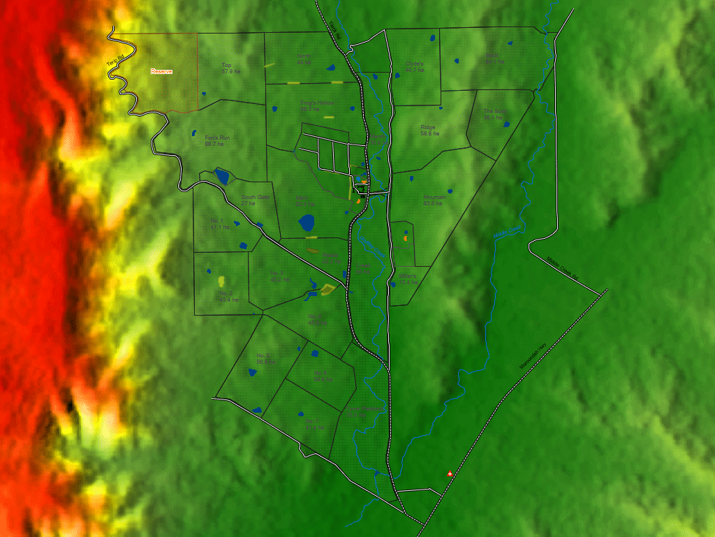
Farm Mapping Software
Farm mapping software that’s simple to use with much of the same functionality of powerful cartographers mapping programs. Phoenix Mapping allows you to create visual layers of your land to help with planning and communication in your operation.
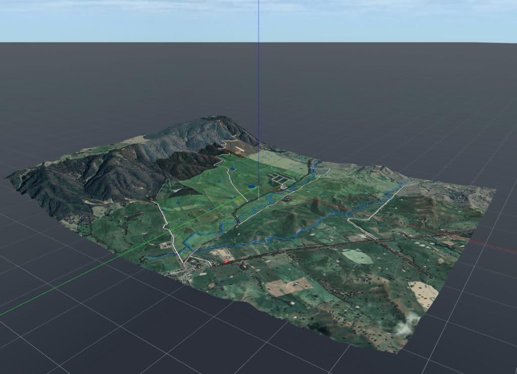
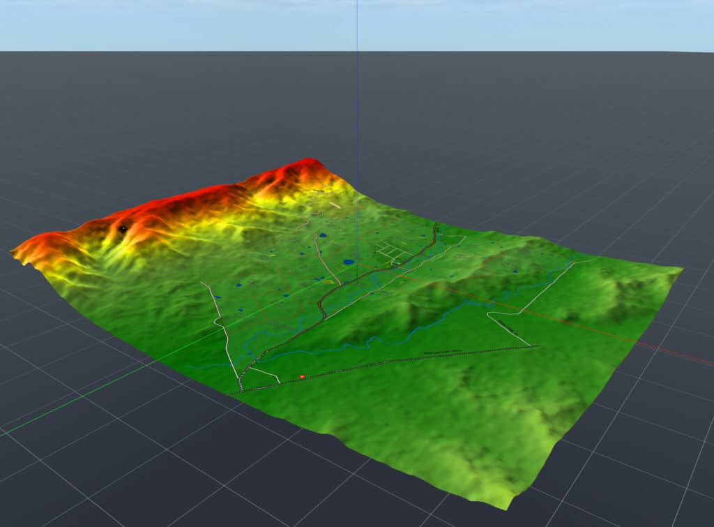
3D Mapping Technology
Infrastructure Planning
A Visual Communication Tool
GPS Farm Mapping Software
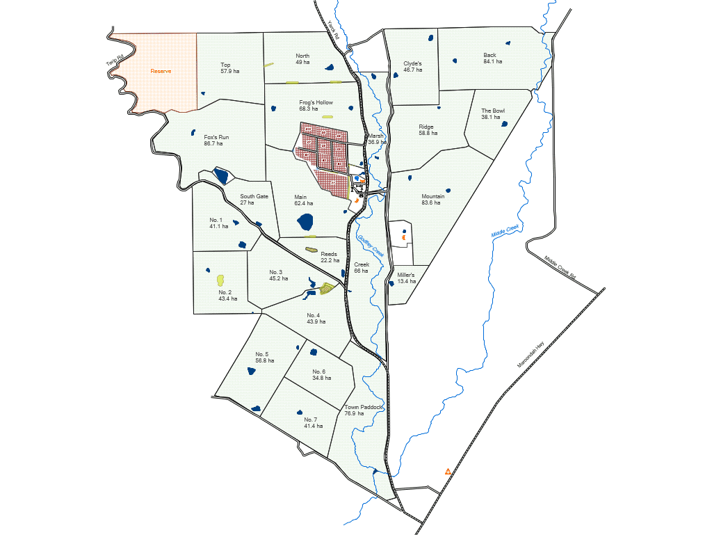
Create Your Own Farm Maps
Add paddock names, farm assets and landscape features to start building an easy to read, visual management tool.
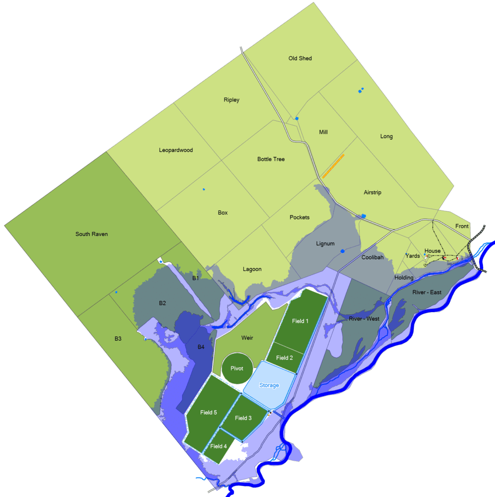
Infrastructure Planning
Use maps to learn where to best place infrastructure like troughs, fences and tanks.
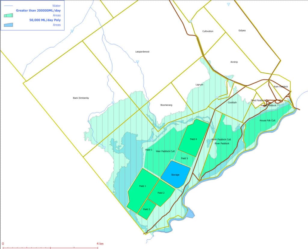
3D Planning & Water Reticulation
Accurately calculate areas and distances with 3D mapping to determine water pressure, as well as equipment required for infrastructure like fencing and irrigation.
Vegetation Mapping
Make better vegetation management decisions and protect vulnerable areas on your property by mapping and monitoring vegetation.

Free weather tool
A bonus product when you subscribe to any Phoenix Live Production modules, the Phoenix weather tool is a simple, handy tool to record meaningful weather data across one or multiple properties.
GIS Farm Mapping Software
WH&S
Workers and visitors have access to maps which highlight hazards, landmarks and UHF & phone signal zones.
Import and Export Maps
Integrate with any other modern GIS mapping software that produces SHP files for importing and exporting maps.
Share with Contractors & Authorities
Export your farm maps in a variety of formats to share with contractors, consultants and authority organisations.
Designed for Farmers
While Phoenix maps are a huge step above our competitors' more basic mapping tools, you don't have to be a cartographer to use or produce them.
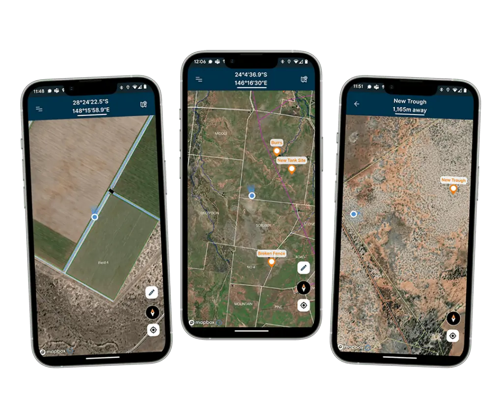
Phoenix Mobile App
Maps Automatically Synced to Devices
All map projects automatically sync to devices with no limit to the number of devices that can be used.
Waypoint and Tracks
Record both waypoints and tracks that are then automatically synced and shared to all devices.
Measure & Real-time Navigation
Ability to measure multiple areas or distances simultaneously. Real-time map tracking even when offline. Navigate back to waypoints & tracks.
Staff Location & Tasks
Dynamic staff tracking to monitor team activities and safety. Seamlessly coordinate personnel and equipment movements. Assign and monitor one time or recurring tasks and track on a map.
* Available on Phoenix Live only.
Testimonials
Access Phoenix Live via the App
Take Phoenix in to the field and update it on the go without being online or in service.
The quickest way to record your properties data for Livestock, Mapping, Cropping, Weather and to capture documents and receipts on the go with Phoenix File Library.